This year we were again able to lead public trips to the infamous Farallon Islands, also called the Devil’s Teeth by mariners for the treacherous rocks and cloak of invisibility that has resulted in numerous shipwrecks and loss of life. Called the Islands of the Dead by the native American Miwok people, the islands are visible from San Francisco on a clear day, but are often cloaked by a veil of fog and mist. There is no evidence the natives ever ventured the 30 miles offshore in their Tule reed canoes, but lore has it that the ghosts of their ancestors settled to rest out at the remote and craggy islands. The months of Sharktober are often the calmest and the clearest out on the Gulf of the Farallones, and the most opportune time to see whales and white sharks.
Although our team was able to dive the islands during COVID, we were unable to share the abundant marine wildlife of the Farallon Island Wildlife Refuge and the Greater Farallones National Marine Sanctuary with our students and the general public in our annual tours.
This fall we were fortunate enough to make 6 public trips out to the islands with two cancellations due to large seas and gale force winds. The Gulf can be treacherous. Most of our voyages this year were met with clear, warm conditions for the Gulf and large groups of humpback whales feeding on the rich plankton generated by the Californian coastal upwelling. These whales, and several other species of cetaceans, visit our Sanctuary waters each summer to feed in the rich abundance of tiny plants and animals, and the fish that feed on them.
Each trip is unique, but one experience in particular this year stands out. This trip on our new vessel the Amigo with Captain Barnett. a commercial crabber, had several teachers naturalists watching lunge feeding Humpbacks in the near distance when one whale broke off and delighted the crew swimming to the boat, rolling, spyhopping and swimming alongside the boat. For over an hour this male entertained us connecting with eye contact and covering us with spray aromatic of the sardines the whales are feasting on. In one instance the whale casually scraped my GoPro camera off the end of the boat pole with a heavy barnacled fluke. This experience is reminiscent of the friendly Grey Whales of the Baja lagoons I experience as a young marine biology student, but never have I had this connection with a Humpback. Finally the whale swam off, leaving behind an overwhelming impression on the passengers and many phone videos and even selfies.

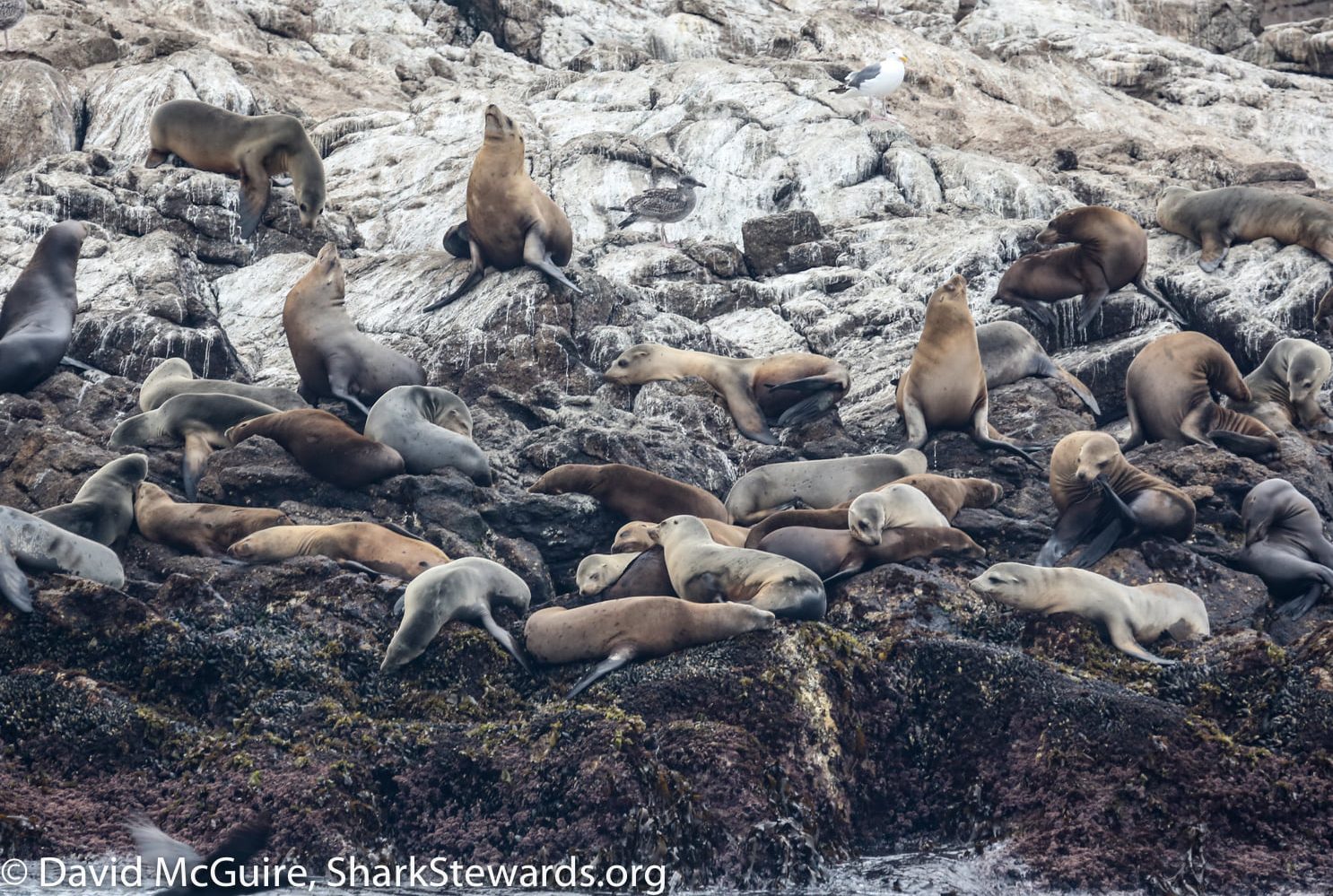
The islands themselves are rich in history, both natural history and of human impact. Once the site of whales, seals and egging, until at last President Theodore Roosevelt protected the Fish and Wildlife system in 1909 as the Farallon National Wildlife Refuge was established to protect seabirds and marine mammals. The Refuge is comprised of four groups of small islands: Southeast Farallon, North Farallons, Middle Farallon, and Noonday Rock. South Farallon Islands is the largest island at 70 acres and was added to the refuge in 1969. The rocky precipices are now covered with thousands of nesting seabirds, seals and sealions and fur seals. During the fall months we call Sharktober, the waters are also visited by white sharks, here to feed following their annual migration from the central Pacific.

Under a NOAA permit issued under the White Shark Stewardship program managed by the Greater farallones National Marine Sanctuary, we are able to deploy a soft decoy equipped with a camera to observe sharks and also identify known and new individuals. On two occasions we did not observe a shark at the surface but after examining the footage from the seal’s camera we observed a shark passing beneath. On one occasion the group aboard was excited by a surface pass from a shark and a revisit a few minutes later. All images are provided to NOAA and the researchers at the Stanford’s TOPP research program. Observations go to support long term monitoring of whales, seabirds and sharks in our National Marine Sanctuary and we hope to increase support for the 15th National Marine Sanctuary to the south in the proposed Chumash Heritage National Marine Sanctuary off the Big Sur coastline of California. Our existing 4 California sanctuaries, and the California marine protected areas collectively help us meet the goals set by the United Nations to protect 30% of our oceans by 2030. To date, the Marine Conservation Institute’s MPA Atlas estimates 7.7% of the world oceans fall under marine protected areas. Most of these fall under national jurisdictions and only 2.8%of the ocean is fully or highly protected from fishing impacts.

Mola molas, black footed albatross, tufted puffins: the panoply of marine life in the Gulf is extraordinary and an example of how we can manage our marine ecosystems and wildlife. We are fortunate to experience the rich marine life, and to have the presence of a public system of marine protection in our National Marine Sanctuary and state marine protected areas. Yet these protections are frail and could be reversed. As experienced in the last administration, political will could open our coastlines to oil exploration. The National Marine Sanctuary system was birthed in response to the 1969 oil spill that killed thousands of seabirds and marine mammals in what is now the Channel Islands National Marine Sanctuary. As seen by the recent Huntington Beach oil spill, our coastal ecosystems are fragile and one mistake could kill thousands of fish, seabirds and marine mammals.
It is is the choice of our community to experience, appreciate and protect whales, sharks and other marine wildlife and the habitat they live in. Our trips exposed another 100 people directly to the wildness of our Sanctuary and I hope with a greater appreciation why we are working to protect 30% of our ocean planet by 2030.